Democratic Underground Latest Greatest Lobby Journals Search Options Help Login
Google

Ike already has an eyewall

Printer-friendly format Printer-friendly format
Printer-friendly format Email this thread to a friend
Printer-friendly format Bookmark this thread
This topic is archived.
Home » Discuss » Archives » General Discussion (1/22-2007 thru 12/14/2010) Donate to DU
 
Strelnikov_ Donating Member (1000+ posts) Send PM | Profile | Ignore Tue Sep-09-08 09:19 PM
Original message
Ike already has an eyewall
Look out Houston.

Hurricane Ike has taken advantage of the warm Gulf of Mexico waters it is over, and has already built an eyewall. At 7:02 m EDT, the Hurricane Hunters found a complete eyewall, which can also be seen on infrared satellite loops and Key West radar. The infrared satellite imagery also shows a rapid cooling of the cloud tops in Ike's eyewall and some of the spiral bands, indicating that the thunderstorms are penetrating higher into the atmosphere--a sign of strengthening. The latest data from a NOAA Hurricane Hunter aircraft indicates that the pressure has begun to fall, but Ike's winds remain at minimal hurricane force, 75 mph. All indications are that Ike will intensify into a very dangerous major hurricane that will hit the Texas coast Friday night or Saturday.


Printer Friendly | Permalink |  | Top
Barack_America Donating Member (1000+ posts) Send PM | Profile | Ignore Tue Sep-09-08 09:27 PM
Response to Original message
1. That storm has a knack for rapid intensification.
Very impressive.

Not going to be a nice weekend for TX, I'm afraid.
Printer Friendly | Permalink |  | Top
 
malaise Donating Member (1000+ posts) Send PM | Profile | Ignore Tue Sep-09-08 09:45 PM
Response to Reply #1
5. The keys are feeling 60mph winds
Dr Steve Lyons on Weather Channel just said this is a Katrina heading for Texas. IT could be Cat 3 or 4.

Get ready for the worse - this is a massive wicked hurricane with unbelievable rain.
Printer Friendly | Permalink |  | Top
 
hatrack Donating Member (1000+ posts) Send PM | Profile | Ignore Tue Sep-09-08 09:36 PM
Response to Original message
2. The good news, of course, that it's veering to the west rather than hitting LA again
But that's one big storm. I haven't seen anything that size since Floyd back in . . . 1999, I think it was.
Printer Friendly | Permalink |  | Top
 
Barack_America Donating Member (1000+ posts) Send PM | Profile | Ignore Tue Sep-09-08 09:41 PM
Response to Reply #2
3. Word is that it's actually tracking more and more north.
But it won't hit NOLA.
Printer Friendly | Permalink |  | Top
 
malaise Donating Member (1000+ posts) Send PM | Profile | Ignore Tue Sep-09-08 09:46 PM
Response to Reply #3
6. Not according to Steve Lyons
He's coming up at 10.50 on Weather Channel.
Printer Friendly | Permalink |  | Top
 
Barack_America Donating Member (1000+ posts) Send PM | Profile | Ignore Tue Sep-09-08 09:48 PM
Response to Reply #6
9. Steve Lyons vs. Jeff Masters.
May the best meteorologist win. ;)
Printer Friendly | Permalink |  | Top
 
lastliberalintexas Donating Member (1000+ posts) Send PM | Profile | Ignore Tue Sep-09-08 09:51 PM
Response to Reply #9
11. And the computer models
They already have it shifted more to the north/east, since earlier today they were showing landfall in Brownsville/N Mexico.

http://www.wunderground.com/tropical/tracking/at200809_model.html#a_topad


It's still too early to really tell anything, but the local weather guys are afraid the high pressure may break down faster than expected. That could mean a more direct hit from Matagorda/Galveston to Houston to Beaumont/Port Arthur.
Printer Friendly | Permalink |  | Top
 
malaise Donating Member (1000+ posts) Send PM | Profile | Ignore Tue Sep-09-08 09:53 PM
Response to Reply #11
13. I've been busy most to today so I haven't been watching the
models. All I recommend is that everyone start paying attention to this monster.
Printer Friendly | Permalink |  | Top
 
lastliberalintexas Donating Member (1000+ posts) Send PM | Profile | Ignore Tue Sep-09-08 09:56 PM
Response to Reply #13
16. We have, unfortunately
I fear that our local emergency people pulled the trigger too early with Gustav, and now people aren't as likely to evacuate for Ike. Some people also can't afford to do it again, just a week later. I just hope they stay safe and get away somehow, from whereever it hits. :(
Printer Friendly | Permalink |  | Top
 
malaise Donating Member (1000+ posts) Send PM | Profile | Ignore Tue Sep-09-08 10:01 PM
Response to Reply #16
18. I think you're right
Where are you in Texas?
Printer Friendly | Permalink |  | Top
 
lastliberalintexas Donating Member (1000+ posts) Send PM | Profile | Ignore Tue Sep-09-08 10:04 PM
Response to Reply #18
21. In Beaumont
Refineries, Cancer Alley and hurricanes. Great slogan for the tourism board, doncha think? :)
Printer Friendly | Permalink |  | Top
 
malaise Donating Member (1000+ posts) Send PM | Profile | Ignore Tue Sep-09-08 10:35 PM
Response to Reply #21
23. Damn after Rita you can't be too calm
until the path is certain.

Not a great slogan :D
Printer Friendly | Permalink |  | Top
 
malaise Donating Member (1000+ posts) Send PM | Profile | Ignore Tue Sep-09-08 09:52 PM
Response to Reply #9
12. LOL
I respect both. Lots of rain still falling in Cuba and Haiti.
Lyons says somewhere between Houston and Corpus Christie. Let me email my niece and tell her to head for her brother.
Printer Friendly | Permalink |  | Top
 
lastliberalintexas Donating Member (1000+ posts) Send PM | Profile | Ignore Tue Sep-09-08 09:54 PM
Response to Reply #12
14. I hope you don't get hit again, malaise
Hopefully Josephine and Lowell (?) just fade away. :)
Printer Friendly | Permalink |  | Top
 
malaise Donating Member (1000+ posts) Send PM | Profile | Ignore Tue Sep-09-08 09:59 PM
Response to Reply #14
17. We're expecting rain but there are no hurricanes in sight right now
Compared with Haiti and Cuba, we've been very lucky. Gustav went through us as a Tropical Storm at 60mph. I saw waves on Cuba's East coast five storeys high. That was unbelievable. We've had comprehensive coverage of both Cuba and Haiti. Friday is the 20th anniversary of Gilbert and we don't need another one like that again.
Weather Channel just said Ike is 500 miles wide - Katrina was 400. WTF!!!!
Printer Friendly | Permalink |  | Top
 
Strelnikov_ Donating Member (1000+ posts) Send PM | Profile | Ignore Tue Sep-09-08 09:47 PM
Response to Reply #2
7. "Texas is highly vulnerable to storm surge"
Edited on Tue Sep-09-08 09:48 PM by loindelrio
http://www.wunderground.com/blog/JeffMasters/comment.html?entrynum=1076&tstamp=200809

Texas is highly vulnerable to storm surge
The Texas coast is highly vulnerable to large storm surges, due to the long expanse of shallow Continental Shelf waters offshore. The shallow depths allow large the swirling winds of the hurricane to pile up huge mounds of water, which then sweep inland when the hurricane makes landfall. Even Category 1 hurricanes are capable of generating 15 foot storm surges along some sections of the Texas coast. For example, the August 29, 1942 hurricane hit near Port O'Connor, Texas as a Category 1 storm with 80 mph winds. However, this hurricane had been a Category 3 storm with 115 mph winds the day before landfall, allowing it to pile up a large storm surge over the Continental Shelf just offshore the central Texas coast. The storm weakened suddenly in the 12 hours before landfall, but brought a storm surge characteristic of a Category 2 or 3 hurricane to shore, since the high angular momentum of the swirling storm surge waters did not have time to decrease much. A 10-15 foot storm surge came ashore over a 100-mile stretch of coast between Port O'Connor and Freeport (Figure 4). Actually, looking at these storm surge values, I wouldn't be surprised if the 1942 storm was stronger both at landfall and before landfall than the official HURDAT database advertises. This storm came before the era of satellites and Hurricane Hunter aircraft.

A realistic worse-case scenario for Texas
There is a significant chance that Ike will be the worst hurricane to hit Texas in over 40 years. The latest run of the HWRF and GFDL models paint a realistic worst-case scenario for Texas. These models bring Ike to the coast as a Category 4 hurricane (which I give a 20% probability of happening). The HWRF predicts a 170-mile stretch of coast will receive hurricane force winds of 74 mph or greater. A 100-mile stretch of coast will receive winds of Category 3 strength and higher, 115 mph. Hurricane force winds will push inland up to 50 miles, along a 50-mile wide region where the eyewall makes landfall. A 100-mile stretch of Texas coast will receive a storm surge of 10-15 feet, with bays just to the right of where the eye makes landfall receiving a 20-25 foot storm surge. This is what Hurricane Carla of 1961 did to Texas. Carla was a Category 4 hurricane with 145 mph winds at landfall, and drove a 10 foot or higher storm surge to a 180-mile stretch of Texas coast. A maximum storm surge of 22 feet was recorded at Port Lavaca, Texas. Despite the fact that the center of Carla hit over 120 miles southwest of Houston, the hurricane drove a 15-foot storm surge into the bays along the south side of the city.


Printer Friendly | Permalink |  | Top
 
lastliberalintexas Donating Member (1000+ posts) Send PM | Profile | Ignore Tue Sep-09-08 09:42 PM
Response to Original message
4. The scary thing is that it's on Rita's track
I don't want it to hit anywhere, but I hope it stays away from SE Texas. I'm not ready to evacuate again. And what would the irony be, with Central to Eastern LA getting hit close to the Katrina anniversary and SE Texas getting hit close to Rita's. Funny.


No offense to Corpus, but it looks like it's your turn. You're definitely due, after skirting close calls the last several years. Stay safe.
Printer Friendly | Permalink |  | Top
 
Strelnikov_ Donating Member (1000+ posts) Send PM | Profile | Ignore Tue Sep-09-08 09:56 PM
Response to Reply #4
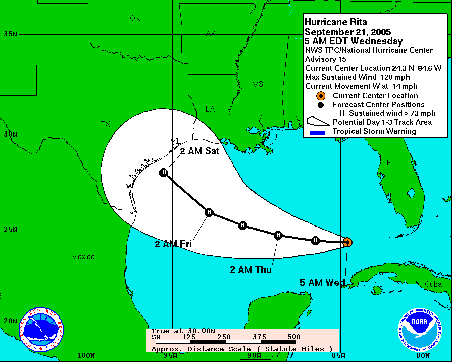
15. Forecast track for Rita at about the same stage
And ended up landing at Port Arthur.

The cone is there for a reason.

Printer Friendly | Permalink |  | Top
 
lastliberalintexas Donating Member (1000+ posts) Send PM | Profile | Ignore Tue Sep-09-08 10:01 PM
Response to Reply #15
19. Yeah, the local news reminded people of that
I think they are justifiably worried that people won't or even can't evacuate again just a week after Gustav (that evac order was issued too quickly), so they are maybe hyping it a little to keep people's attention. They are reminding people that Rita was also forecast to his Corpus, then Galveston, then actually hit us. And it moved north because a high pressure system deteriorated faster than expected. :shrug:


I'm going to just ignore the models, because Corpus is due. I don't wish it on them, but I can't believe that they haven't had a direct hit in the last several active years, but I can't think of one?
Printer Friendly | Permalink |  | Top
 
malaise Donating Member (1000+ posts) Send PM | Profile | Ignore Tue Sep-09-08 10:03 PM
Response to Reply #15
20. And this one is moving slower
9mph
Printer Friendly | Permalink |  | Top
 
Fuzz Donating Member (1000+ posts) Send PM | Profile | Ignore Tue Sep-09-08 09:47 PM
Response to Original message
8. I heard a report that the water temp was 89 degrees
so that should feed it quite a bit.
Printer Friendly | Permalink |  | Top
 
Strelnikov_ Donating Member (1000+ posts) Send PM | Profile | Ignore Tue Sep-09-08 09:50 PM
Response to Reply #8
10. Yep. It's feeding time.
Printer Friendly | Permalink |  | Top
 
Strelnikov_ Donating Member (1000+ posts) Send PM | Profile | Ignore Tue Sep-09-08 10:10 PM
Response to Original message
22. May want to start thinking about topping off the tanks
Models show 'massive devastation' in Houston

Dodson's firm modeled more than 100 storms of varying power, speed and landfall. It concluded that a large Category 4 or Category 5 -- a storm only moderately larger than the four that struck Florida last summer -- would cause as much as $40 billion to $50 billion in damage. That's 10 times the cost of Tropical Storm Allison and approximately the city of Houston's entire budget for the next 15 years.

And this wasn't an academic exercise. Of the 17 Category 4 and Category 5 storms that have struck the United States since 1900, three, all Category 4 storms, have hit the Greater Houston area -- unnamed storms in 1900 and 1915 and Carla in 1961.


http://www.chron.com/content/chronicle/special/05/hurricane/index.html

http://www.chron.com/disp/story.mpl/metropolitan/3046592.html

http://www.khou.com/weather/stormsurgemap.htm


12.1% of US refining capacity adjacent to coastal waterways in greater Houston


BP Texas City 437 kbbl/dy
Marathon Texas City 72 kbbl/dy
Valero Texas City 210 kbbl/dy

http://maps.google.com/?ie=UTF8&ll=29.36759,-94.92033&spn=0.056325,0.07802&t=h&z=14


ExxonMobil Baytown 557 kbbl/dy

http://maps.google.com/?ie=UTF8&ll=29.744184,-95.006847&spn=0.056115,0.07802&t=h&z=14


Shell Deer Park 334 kbbl/dy

http://maps.google.com/?ie=UTF8&ll=29.718396,-95.12229&spn=0.05613,0.07802&t=h&z=14


Crown Central Pasadena 100 kbbl/dy

http://maps.google.com/?ie=UTF8&ll=29.727713,-95.202198&spn=0.028062,0.03901&t=h&z=15


Lyondell Houston 270 kbbl/dy

http://maps.google.com/?ie=UTF8&ll=29.712246,-95.226617&spn=0.028067,0.03901&t=h&z=15


Valero Houston 83 kbbl/dy

http://maps.google.com/?ie=UTF8&ll=29.719514,-95.251465&spn=0.028065,0.03901&t=h&z=15
Printer Friendly | Permalink |  | Top
 
DU AdBot (1000+ posts) Click to send private message to this author Click to view 
this author's profile Click to add 
this author to your buddy list Click to add 
this author to your Ignore list Mon May 06th 2024, 10:18 AM
Response to Original message
Advertisements [?]
 Top

Home » Discuss » Archives » General Discussion (1/22-2007 thru 12/14/2010) Donate to DU

Powered by DCForum+ Version 1.1 Copyright 1997-2002 DCScripts.com
Software has been extensively modified by the DU administrators


Important Notices: By participating on this discussion board, visitors agree to abide by the rules outlined on our Rules page. Messages posted on the Democratic Underground Discussion Forums are the opinions of the individuals who post them, and do not necessarily represent the opinions of Democratic Underground, LLC.

Home  |  Discussion Forums  |  Journals |  Store  |  Donate

About DU  |  Contact Us  |  Privacy Policy

Got a message for Democratic Underground? Click here to send us a message.

© 2001 - 2011 Democratic Underground, LLC