http://www.spacemart.com/reports/ESA_Presents_The_Sharpest_Ever_Satellite_Map_Of_Earth_999.htmlEARTH OBSERVATION
ESA Presents The Sharpest Ever Satellite Map Of Earth
GlobCover bimonthly global composite for May to June 2005 based on Envisat's Medium Resolution Imaging Spectrometer (MERIS) instrument working in Full Resolution Mode with a spatial resolution of 300 metres. Credits: ESA - MEDIAS France
by Staff Writers
Paris, France (ESA) May 14, 2007
The most detailed portraits ever of the Earth's land surface have been created with ESA's Envisat environmental satellite. The portraits are the first products produced as part of the ESA-initiated GlobCover project and are available online. Bimonthly global composites for May to June 2005 and March to April 2006 can be accessed through a newly developed map server tool on ESA's GlobCover website. On 19 June, additional bimonthly global composites will be made available as well as the first part of a global land cover map over Eurasia.
Around 40 terabytes of imagery - an amount of data equivalent to the content of 40 million books - were acquired between December 2004 and June 2006 and processed to generate the global composites. The composites will support the international community in modelling climate change extent and impacts, studying ecosystems and plotting worldwide land-use trends.
The United Nations Environment Programme's (UNEP) Ron Witt said: "The GlobCover data sets should allow UNEP to do frequent monitoring of environmentally-critical sites and known 'hot spots' in areas we have under examination around the globe, and to update our knowledge of such changing environmental conditions, in order to alert the global community to emerging problems before it is too late for decision-makers and civil society to take action in this regard."
Jean-Louis Weber highlighted the importance of the GlobCover products in the framework of the European Environmental Agency (EEA): "From the point of view of time scales, the contribution expected from GlobCover is of paramount importance. Combined with the Corine data on which the current accounts of land cover change at the European scale are based, a regularly updated GlobCover is expected to play a key role in the implementation of nowcasting procedures, necessary for delivering up-to-date data on land cover change at the European scale at a pace compatible with the main socio-economic indicators."
The Food and Agriculture Organization of the United Nations (FAO) will use GlobCover products to support many of its activities. "GlobCover products should constitute an important interpretation asset in support of more dynamic environmental parametres such as rainfall and vegetation condition for FAO's global and national food security early warning programmes on which ESA and FAO cooperate closely," FAO's Dr. John Latham explained.
"It will also significantly contribute to the monitoring and assessment of global land cover and as such will support the contribution of FAO to the assessment of land degradation and the monitoring of global forest cover."
end of excerpt.
http://www.esa.int/esaEO/SEMGSY2IU7E_index_0.htmlThis type of satelite can go a long way in pointing out areas of need in our world in order to prompt the proper responses to hopefully prevent a calamity. Looking at the current image, seeing Australia and Africa is frightening. Considering the impact the climate crisis is now having upon our world this is much needed and will hopefully wind up saving lives.
This is also along the lines of Triana, a project proposed by Al Gore (another innovative and visionary concept before its time) in the late nineties and trashed by a Congress that once again did not understand the world we live in. America once again could have been in the forefront regarding climate change, but once again chose to put partisanship and greed above the moral imperative.
http://www.space.com/scienceastronomy/planetearth/triana_approval_000308.html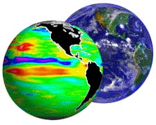
Earth view using Triana
Triana-cancelled in 2006 after sitting in storage while our Earth melted. At least now we have something to give us a perception of the extent of the damage we are doing to this planet.